 BGS Data Catalogue
Carbon dating
Type of resources
Topics
Keywords
Contact for the resource
Provided by
Years
Formats
Update frequencies
-

Age-depth models for Pb-210 datasets. The St Croix Watershed Research Station, of the Science Museum of Minnesota, kindly made available 210Pb datasets that have been measured in their lab over the past decades. The datasets come mostly from North American lakes. These datasets were used to produce both chronologies using the 'classical' CRS (Constant Rate of Supply) approach and also using a recently developed Bayesian alternative called 'Plum'. Both approaches were used in order to compare the two approaches. The 210Pb data will also be deposited in the neotomadb.org database. The dataset consists of 3 files; 1. Rcode_Pb210.R R code to process the data files, produce age-depth models and compare them. 2. StCroix_agemodel_output.zip Output of age-model runs of the St Croix datasets 3. StCroix_xlxs_files.zip Excel files of the St Croix Pb-210 datasets
-
A Bayesian age-depth model was constructed of the radiocarbon dates of the MexiDrill composite core. The age-depth model was produced using rbacon (Blaauw and Christen 2011, Bayesian Analysis 6(3): 457-474, doi: 10.1214/11-BA618), and was run in R as rbacon (CRAN version 3.2.0) using all default settings except for: thick=0.2, depth.units="m", ka=TRUE, acc.mean=2000. The output consists of a pdf of the age-depth model and its settings, a file containing the 95% age ranges, medians and means for every 0.1m of the core depths, a settings file and the .csv file that was used to produce the age-depth model. During the age-modelling, rbacon used the IntCal20 northern hemisphere terrestrial calibration curve (Reimer et al. 2020, Radiocarbon 62, 725-757, doi:10.1017/RDC.2020.41).
-
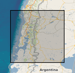
Stratigraphic and ecological data from tidal marsh sites in south-central Chile. Includes stratigraphy, diatom assemblages and radiocarbon dates from fossil cores and diatom assemblages from modern tidal marsh samples. Data were collected to provide evidence for multiple great earthquakes in south-central Chile, and enable the reconstruction of vertical land-level changes associated with these earthquakes. Data are from tidal marsh sites within the 1960 earthquake rupture area along the Chilean subduction zone (37.5 - 46 degrees South).
-

Radiocarbon dates on Kauri wood from the Late Glacial (Hogg et al 2016) and around Heinrich Event 3 (Turney et al 2016). The radiocarbon dates are on dendrochronological sequences of rings with known age separation and useful for calibration of other radiocarbon dates and looking at geophysical processes.
-
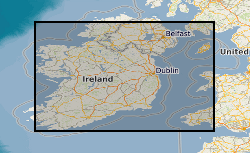
Due to differential loading of ice on Britain and Ireland the glacial isostatic adjustment (GIA) response and therefore sea-level record will vary with distance from the centre of the British Irish Ice Sheet. GIA models are tested against geological observations, however there is a paucity of observations below -10m depth and the lateglacial period when the BIIS retreated leading to a rapid response of both sea-level and GIA. The aim of the project was to use geophysical data, ground truthed by core material, to find evidence of lateglacial sea-level minima in the Irish and Celtic Sea to refine these GIA models. Cruise log and digital copies of the core information (location, water depth, core length) taken onboard the research cruise CE12008 on the RV Celtic Explorer. A GeoReseource 6m vibrocorer was used to collect sediment samples. Cores where taken at multiple sites and from southern and eastern Ireland: Bantry Bay, Dunmanus Bay, Waterford,Offshore County Louth and Dundalk Bay, offshore Isle of Man; offshore Wales: Cardingan Bay; and offshore Northern Ireland: Kilkeel and Dundrum Bay, Belfast Lough.
-
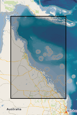
Four datasets for NERC grant NE/J023329/1, Paluma Shoals reef complex, Halifax Bay, central Great Barrier Reef, Australia. DATASET 1: Single Beam acoustic survey data. This dataset comprises the single beam acoustic data that was collected from transects across the Paluma Shoals reef complex, Halifax Bay, central Great Barrier Reef, Australia. The dataset comprises of depth measurements (m) and the latitudinal and longitudinal coordinates of 58,255 point samples across the study area. The dataset was used to construct Figure 1C in Morgan, K. M., Perry, C. T., Smithers, S. G., Johnson, J. A., & Daniell, J. J. (2016). Evidence of extensive reef development and high coral cover in nearshore environments: implications for understanding coral adaptation in turbid settings. Scientific Reports, 6. DATASET 2: Paluma Shoals core data (sedimentology and palaeoecology This dataset includes all collected sedimentary and coral palaeoecological data collected from cores from across the Paluma Shoals Reef Complex, Halifax Bay, central Great Barrier Reef, Australia. This includes 1) a list of the cores recovered, their geographic location and their depths; 2) data on the mud and carbonate content of the sediment matrix from each core; 3) grainsize data from each core; 4) data from thin section analysis from each delineated facies in cores; and 5) downcore data on coral constituent abundance. DATASET 3: Core radiocarbon dates This dataset comprises the radiocarbon dates obtained from coral samples from cores collected across the Paluma Shoals Reef Complex, Halifax Bay, central Great Barrier Reef, Australia. Dates are from the NERC Radiocarbon dating lab (SUERC) in East Kilbride. DATASET 4: Benthic video imagery This dataset comprises screen grab images collected along towed transects across the Paluma Shoals reef complex, Halifax Bay, central Great Barrier Reef, Australia. Each image has the relevant lat, long coordinates printed on the top right hand corner. The sites names (folders) relate to the sites described in the following paper: Morgan KM, Perry CT, Smithers SG, Daniell JJ and Johnson JA (2016) Extensive reef development within the “mesophotic” nearshore Great Barrier Reef: Evidence for intra-regional variations in coral resilience. Scientific Reports 6:29616. DOI: 10.1038/srep29616